When is Vietnam’s Typhoon Season? A Guide by City
Last Updated on 2025/09/27 by Seo
Vietnam is divided into three distinct regions: North, Central, and South. Each region experiences different climates, which means typhoon seasons vary significantly across the country. Typhoons and their accompanying floods represent one of Vietnam’s most serious natural disasters.
On average, 4-6 typhoons affect Vietnam annually. According to UN reports, climate change is increasing both the frequency and intensity of typhoons impacting the region. [1]
Since Vietnam is extremely vulnerable to typhoons, this guide provides detailed, city-specific information about typhoon timing and frequency to help you plan your travels safely.
Vietnam Typhoon Season at a Glance:
- Northern Vietnam (Hanoi, Ha Long Bay): June – October (Peak: July-August)
- Central Vietnam (Da Nang, Hoi An): September – November (Peak: October)
- Southern Vietnam (Ho Chi Minh City, Phu Quoc): Minimal risk, but occasional storms from May to October.

Our Criteria for Vietnam Typhoon Data
While numerous typhoons occur globally each year, their paths, timing, and frequency are meticulously documented in databases worldwide. We’ve analyzed typhoon data using these specific criteria, with typhoon track images sourced from NOAA:
- Data Source: Official typhoon statistics from the National Oceanic and Atmospheric Administration (NOAA)
- Time Period: 10 years from 2012 to 2022
- Typhoon Definition: Maximum sustained winds of 63 km/h (39 mph) or higher
- Geographic Impact: Only typhoons that made direct landfall or passed very close to mainland Vietnam
When is Typhoon Season in Hanoi?
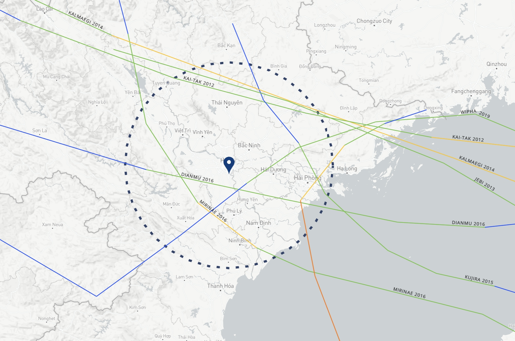
Hanoi experiences four distinct seasons, making its climate more familiar to visitors from temperate countries. The city’s typhoon season runs from June through October, with peak activity in July and August.
This timing matches the typical typhoon season across Southeast Asia. After typhoons pass through, tourism to nearby attractions like Ha Long Bay and Sapa can become difficult. Typhoons often leave Ha Long Bay littered with debris and floating waste, while Sapa faces increased landslide risks in its mountainous areas.
Hanoi Monthly Typhoon Frequency (2012-2022):
- June: 1 occurrence
- July: 3 occurrences
- August: 2 occurrences
- September: 1 occurrence
- October: 1 occurrence
Based on frequency, this averages about 0.8 typhoons per year. However, since 2012 and 2016 each had 2 typhoons, it’s more accurate to say Hanoi experiences significant typhoon impact roughly every 2 years.
When is Typhoon Season in Da Nang?

Based on our 10-year analysis, 9 typhoons directly impacted Da Nang, with activity concentrated from late September through late October.
Da Nang Monthly Typhoon Frequency (2012-2022):
- September: 3 occurrences
- October: 5 occurrences
- November: 1 occurrence
While this averages about 1 typhoon per year, Da Nang holds the unfortunate distinction of being Vietnam’s most typhoon-affected city over the past 70 years. [2]
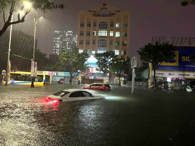
The impact of these storms is severe. For example, Super Typhoon Noru, which struck Da Nang in 2022, resulted in dozens of missing persons, hundreds of injuries, and displaced over 400,000 people. The storm flooded approximately 90,000 homes, highlighting the city’s significant challenges with its drainage system. [3]
Furthermore, the aftermath of a typhoon often leaves the city’s beaches in disarray. Strong winds litter the coastline with all kinds of trash, driftwood, and fallen leaves. For these reasons, it is best to avoid visiting Da Nang entirely in the days immediately before and after a typhoon.
When is Typhoon Season in Nha Trang?

Nha Trang boasts some of Vietnam’s best weather year-round. Locals say the city enjoys 300 sunny days per year, and typhoons rarely affect this coastal city. Over our 10-year analysis period, only 3 typhoons directly impacted Nha Trang, concentrated in late October to early November.
Nha Trang Monthly Typhoon Frequency (2012-2022):
- October: 2 occurrences
- November: 1 occurrence
What is the Typhoon Risk in Ho Chi Minh City?
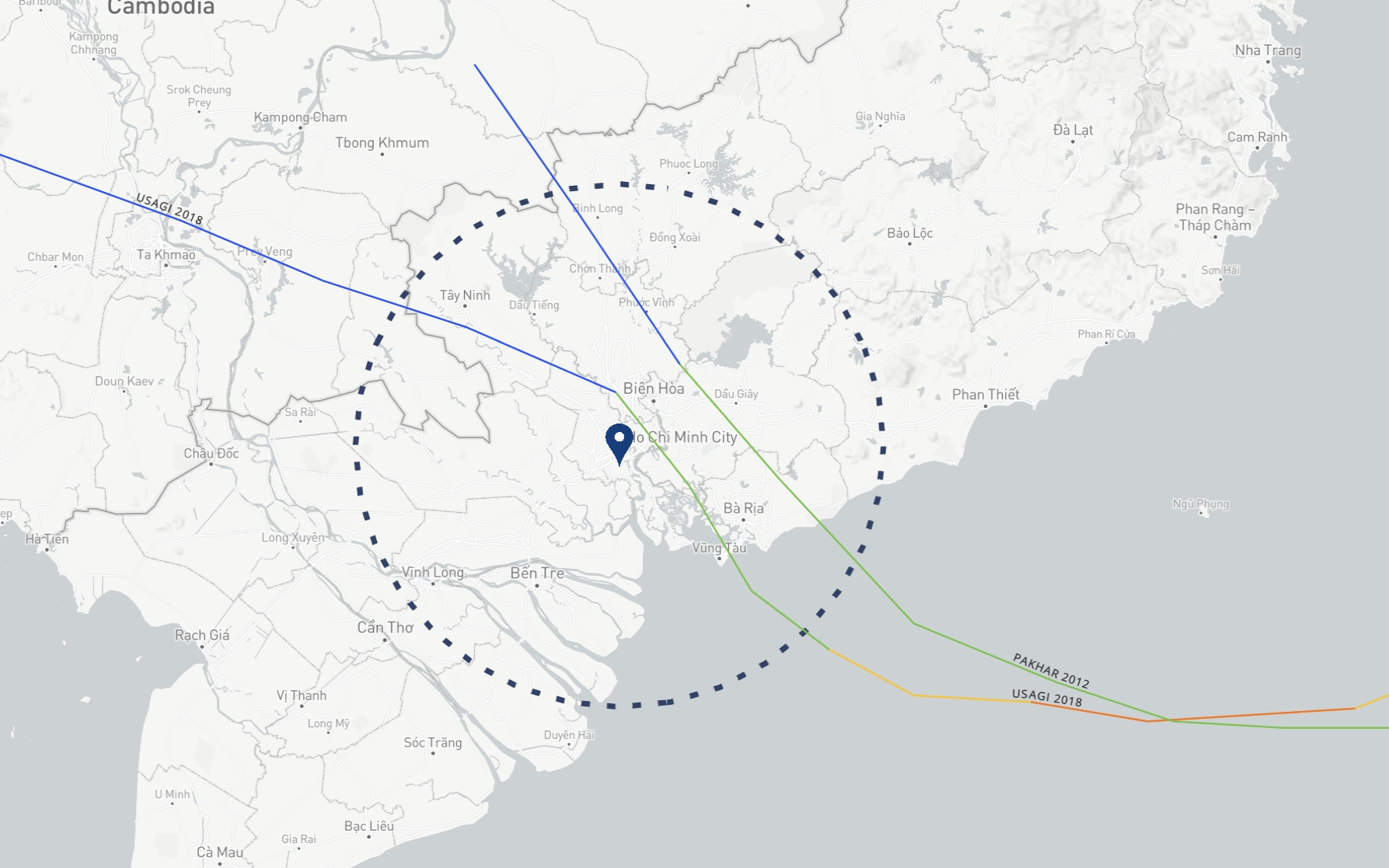
If you’re planning to visit Ho Chi Minh City, you generally don’t need to worry about typhoons. Over the past 10 years, only 2 typhoons (in 2012 and 2018) directly affected the city. Like many elongated countries, Vietnam sees hotter temperatures and fewer typhoons the further south you travel.
Ho Chi Minh City Monthly Typhoon Frequency (2012-2022):
- May: 1 occurrence
- October: 1 occurrence
Is Phu Quoc Affected by Typhoons?

Phu Quoc, Vietnam’s southernmost island, experienced zero typhoon impacts over the past 10 years. Even when expanding our criteria to include tropical depressions that don’t meet full typhoon standards, no storms directly targeted Phu Quoc. You can visit Phu Quoc without typhoon concerns.
Tip: Track Vietnam Typhoons in Real-Time
If you’re visiting Northern or Central Vietnam during their peak seasons, you must check typhoon information beforehand. Regular weather forecasts don’t provide the detailed storm tracking you need. This is where specialized real-time typhoon tracking tools become essential.
The most reliable platform is Windy.com. Unlike basic weather apps, Windy provides professional meteorological visualization. You can see wind patterns, wave heights, and typhoon paths on a real-time map.

Why We Recommend Windy:
- Reliability: Windy’s greatest strength lies in comparing multiple weather prediction models side-by-side, including ECMWF (European) and GFS (American). This gives you a more accurate prediction than relying on a single forecast.
- Powerful Tracking: The Hurricane Tracker feature lets you monitor active typhoons in real-time, predicting landfall timing and paths.
- Intuitive Interface: Despite providing professional-grade information, the map-based interface is extremely user-friendly. It is available as mobile apps (iOS/Android).
- https://vietnam.un.org/en/9282-viet-nam-special-report-managing-risks-extreme-events-disasters-advance-climate-change[↩]
- https://vmrcc.gov.vn/thong-tin-khi-tuong-thuy-van/nhung-con-so-biet-noi-ve-bao-vao-viet-nam-trong-70-nam-qua-728.html[↩]
- https://reliefweb.int/report/viet-nam/viet-nam-monsoon-storms-and-floods-2022-dref-application-mdrvn021[↩]
Leave a Reply